CZI CZI UAV Platform Platform
Space-Ground Coordination, Ultimate Control
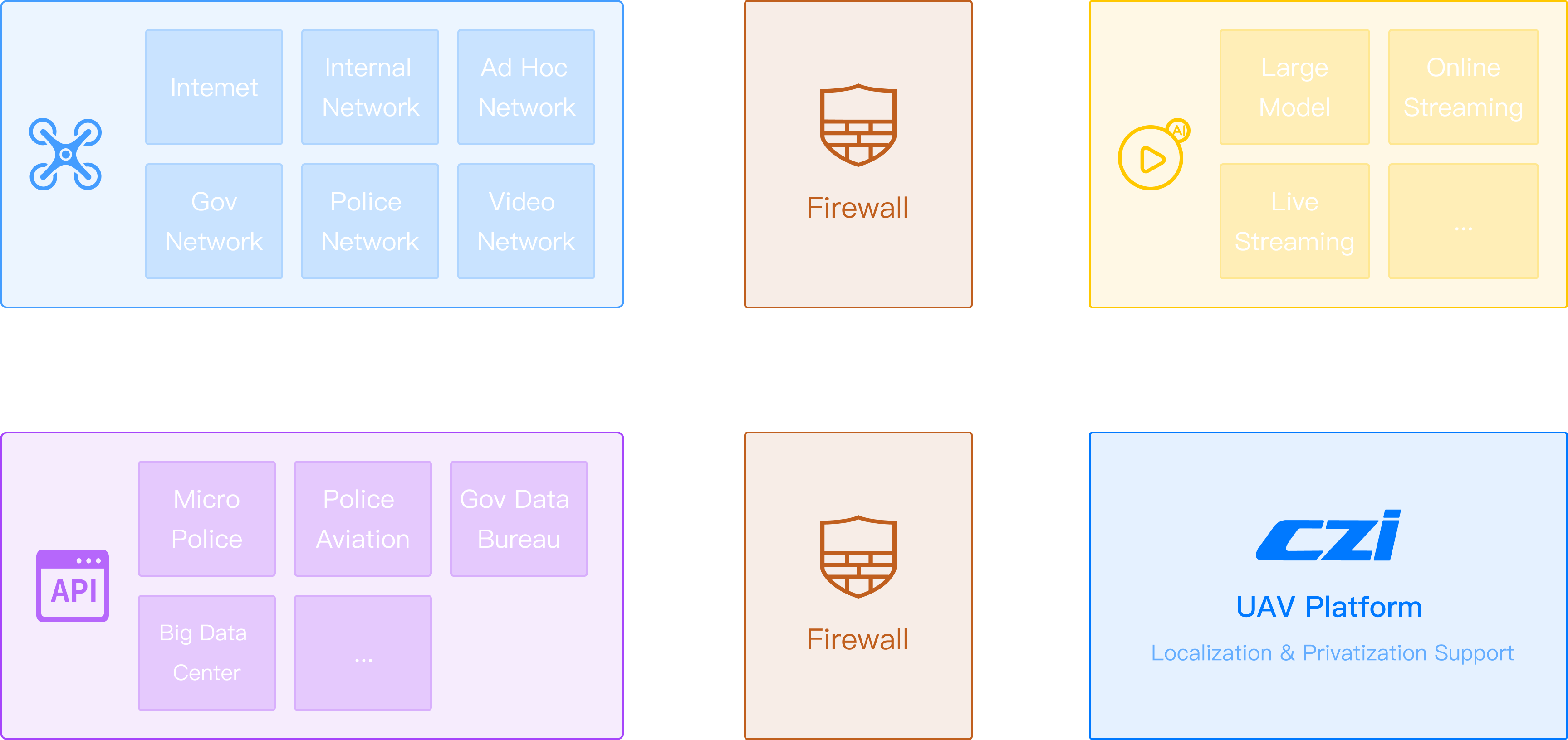
CZI UAV platform focuses on low-altitude flight management, providing mature full-process, full-scenario, and all-element solutions for industries including public security, fire protection, hydrology, forestry, construction, mining, and power. By deeply integrating intelligent algorithms and AI large models, the platform drives the intelligentization, precision, and refinement of UAV operations.
Platform Advantages


Virtual Navigation, Collaborative Cooperation
Leveraging an integrated sky-ground grid view, the platform enables rapid dispatch of devices, personnel, and data for precise and on-demand deployment.
Intelligent Route, Timed Patrols
The platform supports flexible route planning and waypoint actions with timed patrol missions.

AI Algorithm, Industry Empowerment
The platform offers 40+ AI intelligent recognition algorithms, and can generate AI results reports for intelligent assessment with a clear presentation.
Sky Eye, Capturing the World
The platform aggregates all mission-collected files to manage the full lifecycle of deliverables from collection to output.
Full-Process Traceability, Escorting the Whole Journey
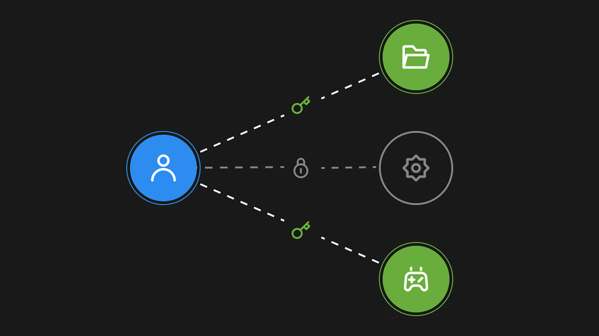
The platform has a robust flight safety system and a refined user permission system to achieve safety control of the entire process.
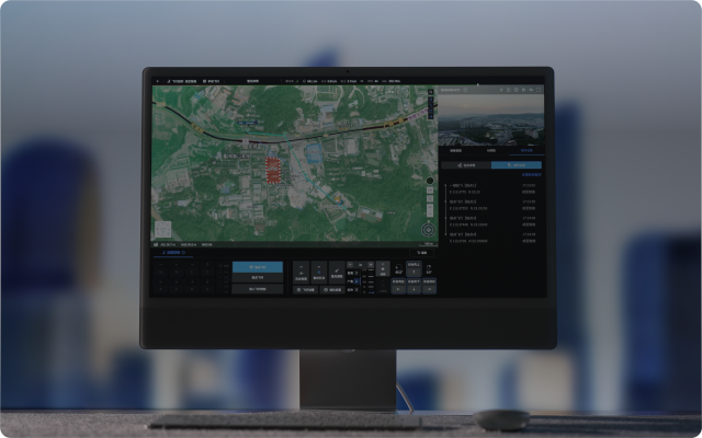
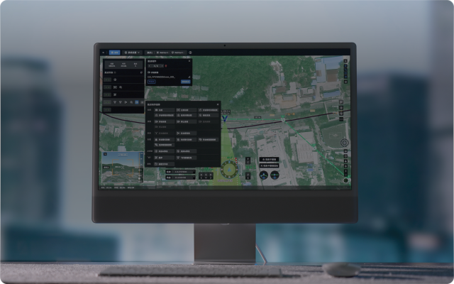
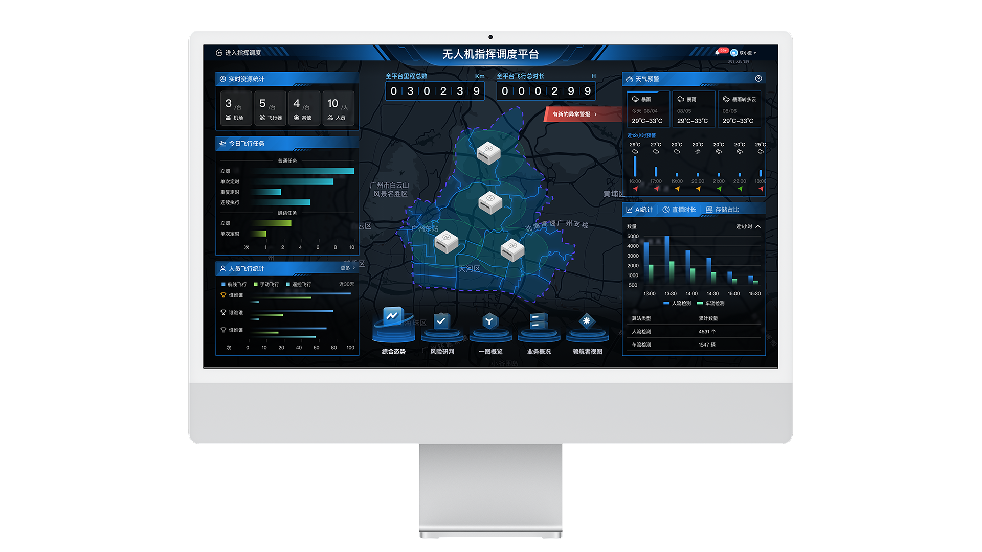
Global Overview, Smart Dispatching
The platform achieves closed-loop management through pre-mission planning, in-process dispatch, and post-event evidence collection.

Diversified Data, Ultimate Protection
The platform features secure private servers and a comprehensive device ecosystem for ultimate protection.
Virtual Navigation, Collaborative CooperationVirtual Navigation, Collaborative Cooperation
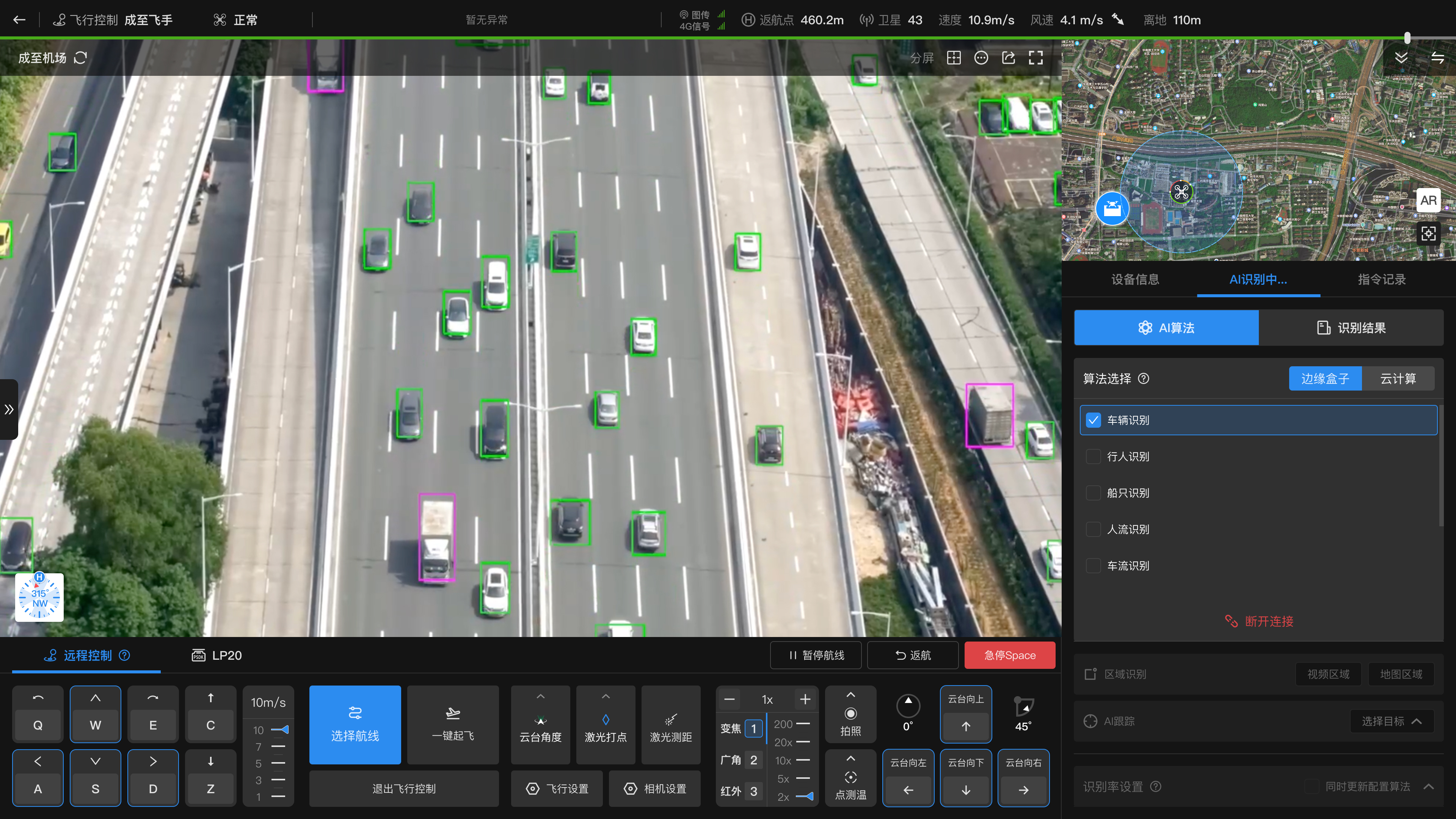
Remote Control, Virtual Flight


Remote Control
Pointing Flight
Payload Control
Users can remotely and accurately control the UAV, and perform operations such as viewpoint tracking, zoom-by-selection, and target reorientation with one click, improving image operation convenience and efficiency.
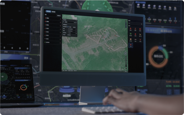
Teamwork, Real-Time Sharing

Map Annotation
Points, line segments and areas can be marked on multiple terminals and placed in shared folders for real-time synchronization to other devices to improve collaboration efficiency.
01/04
AI Algorithm, Industry EmpowermentAI Algorithm, Industry Empowerment
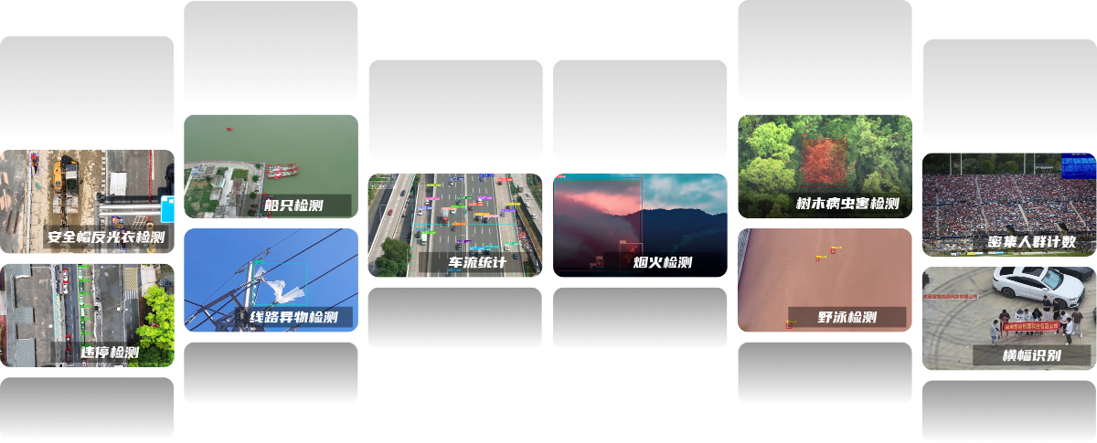
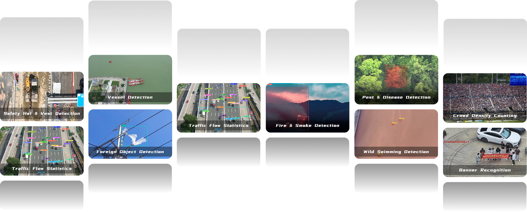
Algorithm Display
More than 40 AI algorithms have been independently developed to build a multi-algorithm matrix covering “people, vehicles, objects, environment, and events”, covering core scenarios such as target recognition, behavior analysis and environmental monitoring to meet the needs of patrol inspection business in multiple industries.
Automatic Alarm, Intelligent Analysis
Algorithm Alarm
AI Results Report
Cloud-Edge integration
Based on the detection results, real-time and fully automatic alarms are issued, and alarm information is recorded at the same time to provide accurate traceability basis for subsequent responses.
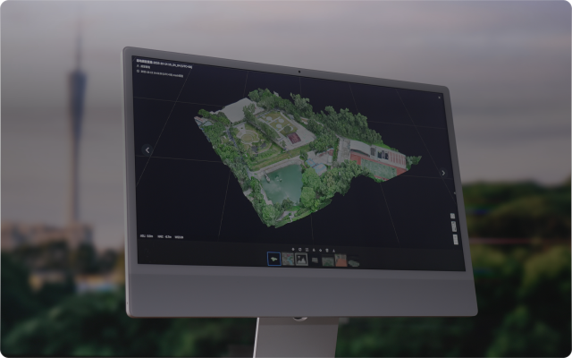
Sky Eye, Capturing the WorldSky Eye, Capturing the World
Results Comparison
Results Sharing
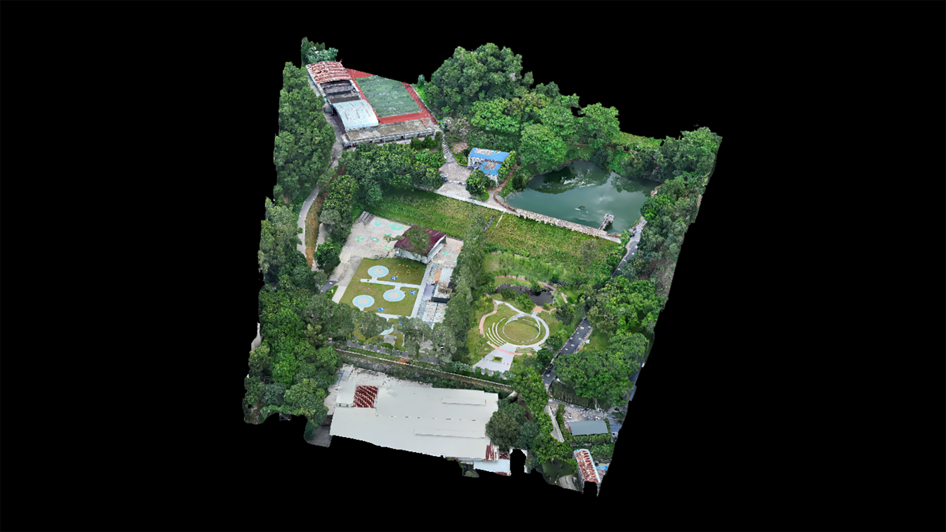
Online Modeling
Model Import
Map Picture
The platform provides professional split-screen comparison functionality, allowing multiple media files or models to be placed in the same view for synchronized analysis, greatly facilitating change detection and detailed analysis work.
Full-Process Traceability, Escorting the Whole JourneyFull-Process Traceability, Escorting the Whole Journey
Safe Operation, Platform Guarantee
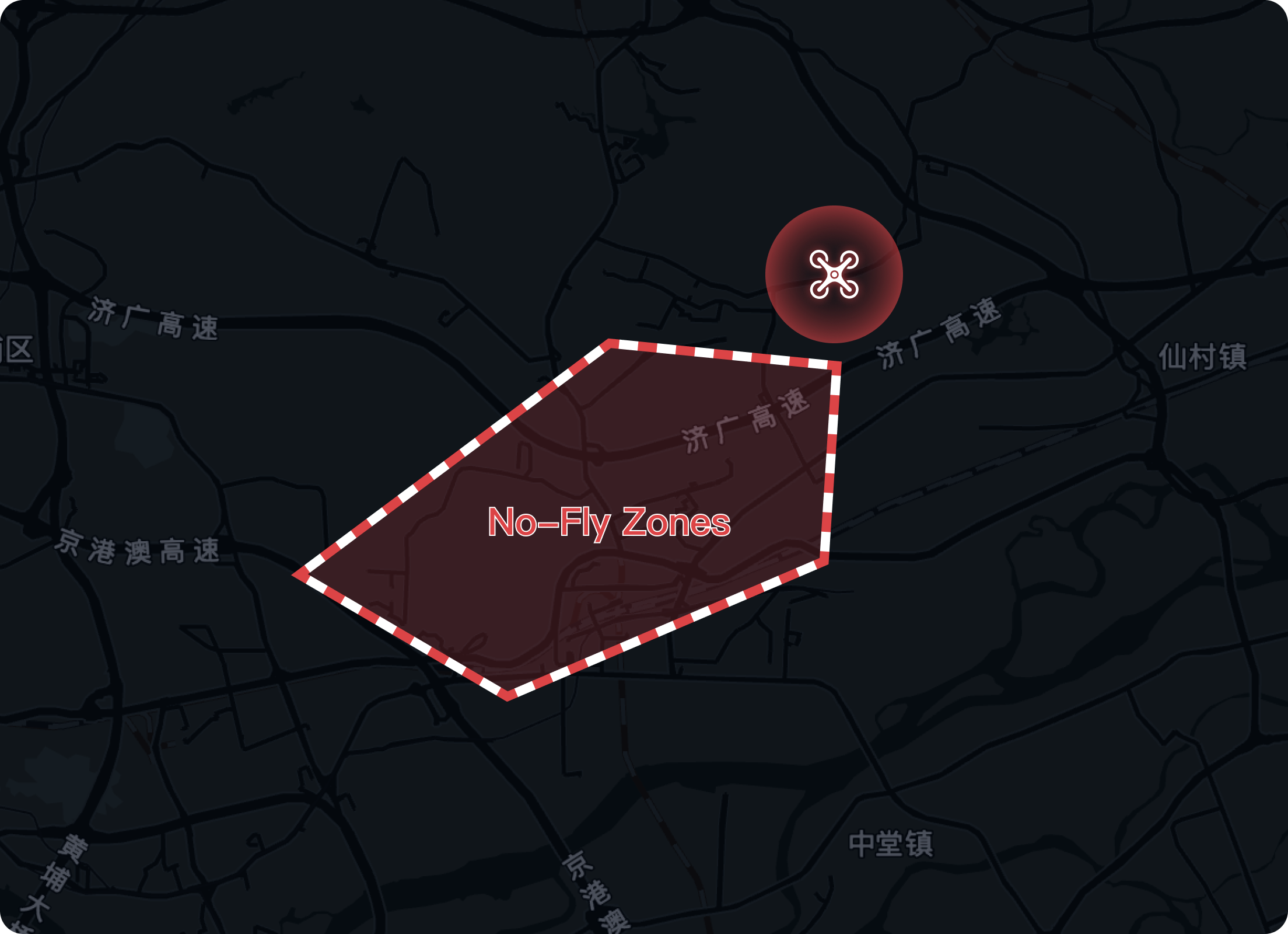


Enables users to define custom flight and restricted areas for precise airspace management, ensuring safe and controlled operations.
Backtracking to the Site, Remote O&M
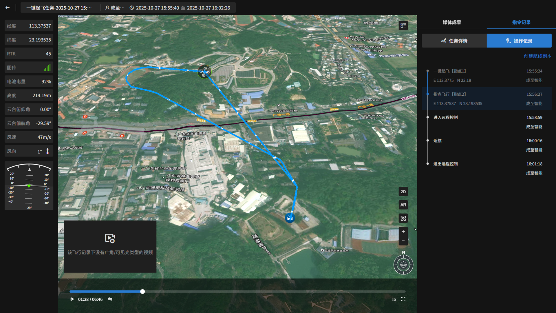
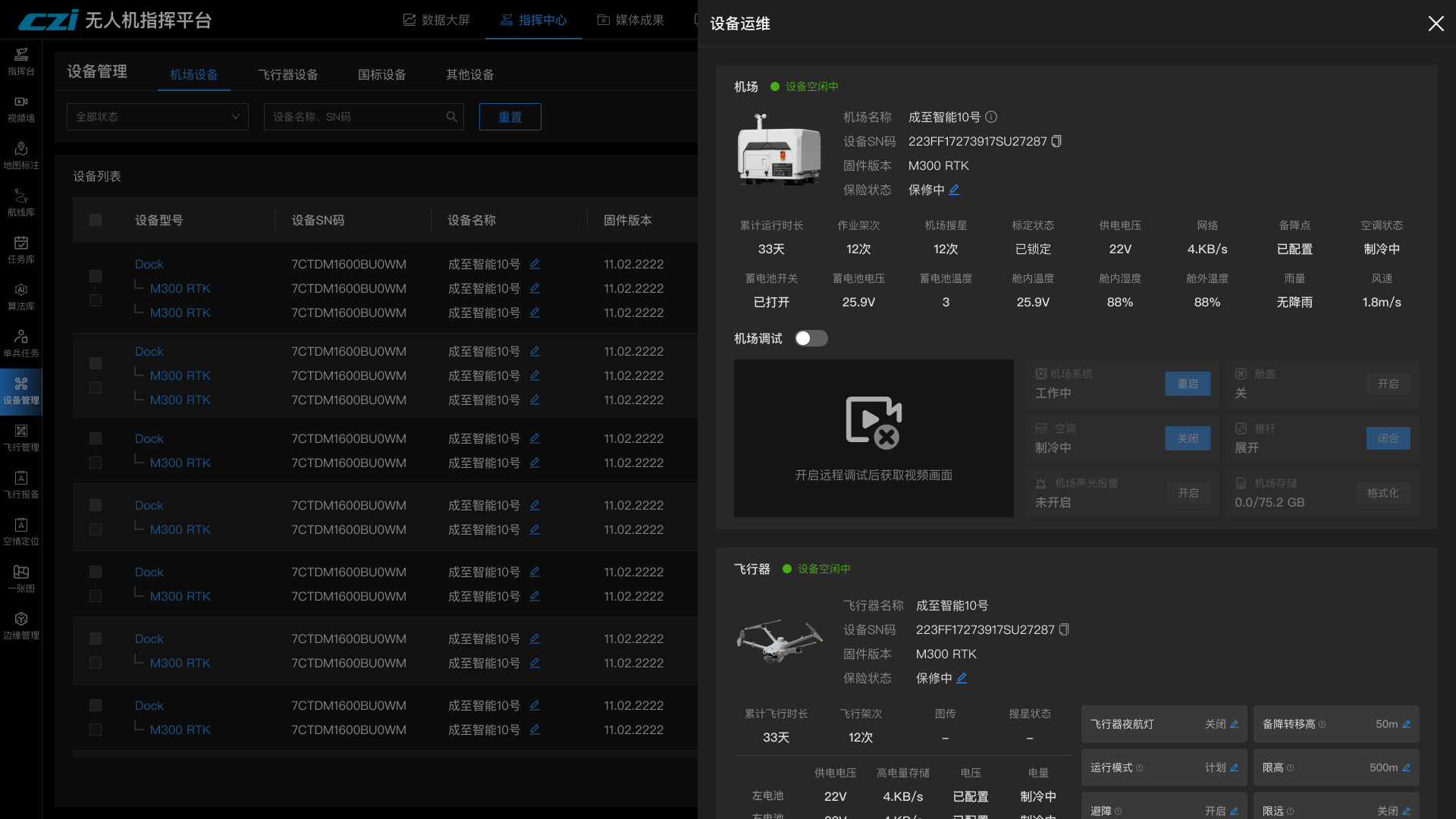
History Playback
The platform completely records the full-link data of the flight, and users can view detailed historical flight data to provide accurate basis for on-site review and post-event analysis.
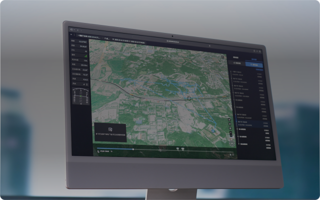
Global Overview, Smart DispatchingGlobal Overview, Smart Dispatching
Electronic Sand Table, Scenario Proposal

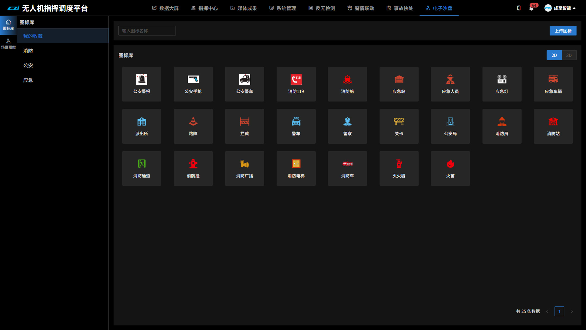
Custom Icon Library
The platform supports a custom icon library, which can be directly used for scenario proposal arrangement to intuitively present key elements on the electronic sand table, thereby effectively enhancing planning efficiency and quality.
01/02
Airspace Planning, Device Sharing
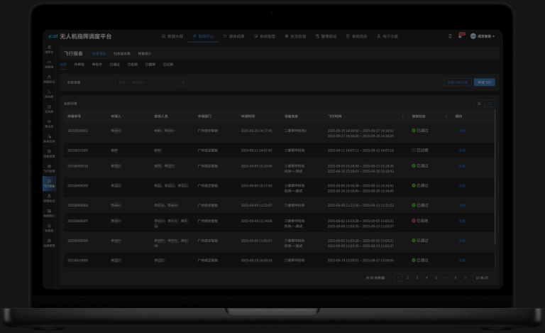
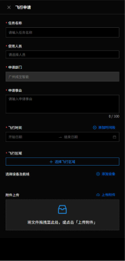

Flight Reporting
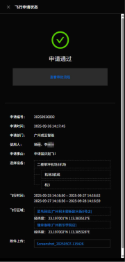
By integrating flight resources and airspace applications in one stop, the platform enables unified management and rapid reporting of mission information, thereby ensuring efficient approval of airspace use and orderly execution of missions.
Space-Ground Linkage, Efficient Collaboration

Individual App
A “platform-individual” task link has been established, where abnormal platform information can be sent to individual tasks, realizing space-ground coordination with an integrated collaborative disposal closed loop.
Accident Quick Response, On-Site Capture
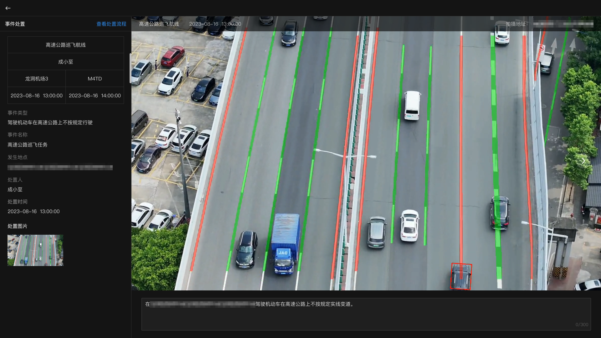
Accident Evidence Collection
The platform supports evidence collection at the site of accidents, forms accident analysis reports, and can push collected evidence data to third-party platforms.
Diversified Data, Ultimate ProtectionDiversified Data, Ultimate Protection
Private Deployment
The platform is based on safe and reliable internal and external network isolation technology to ensure data security, and adapts to domestic servers, providing customers with a solid foundation for full-stack control.
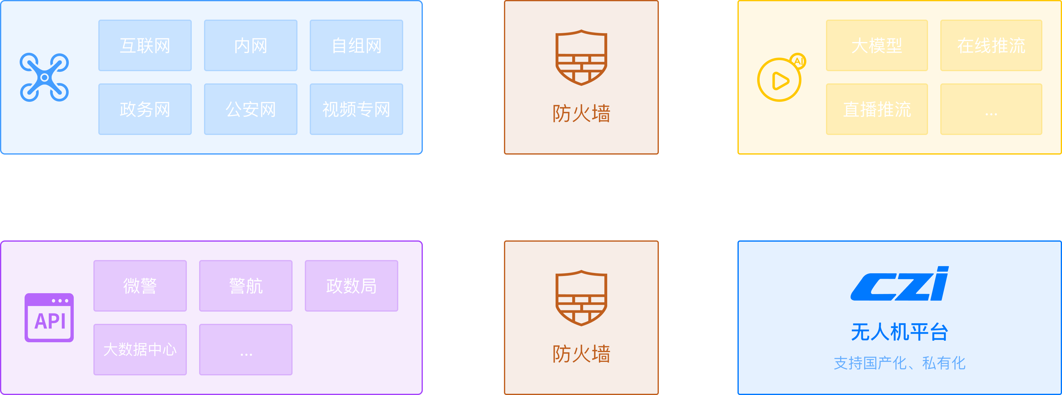
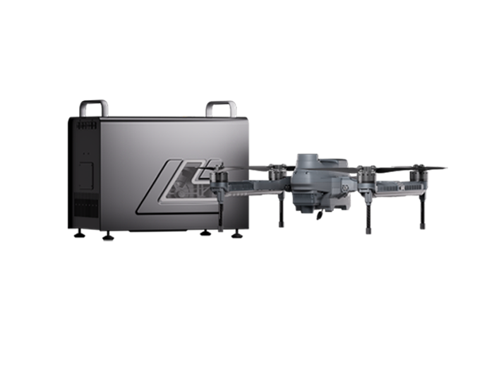
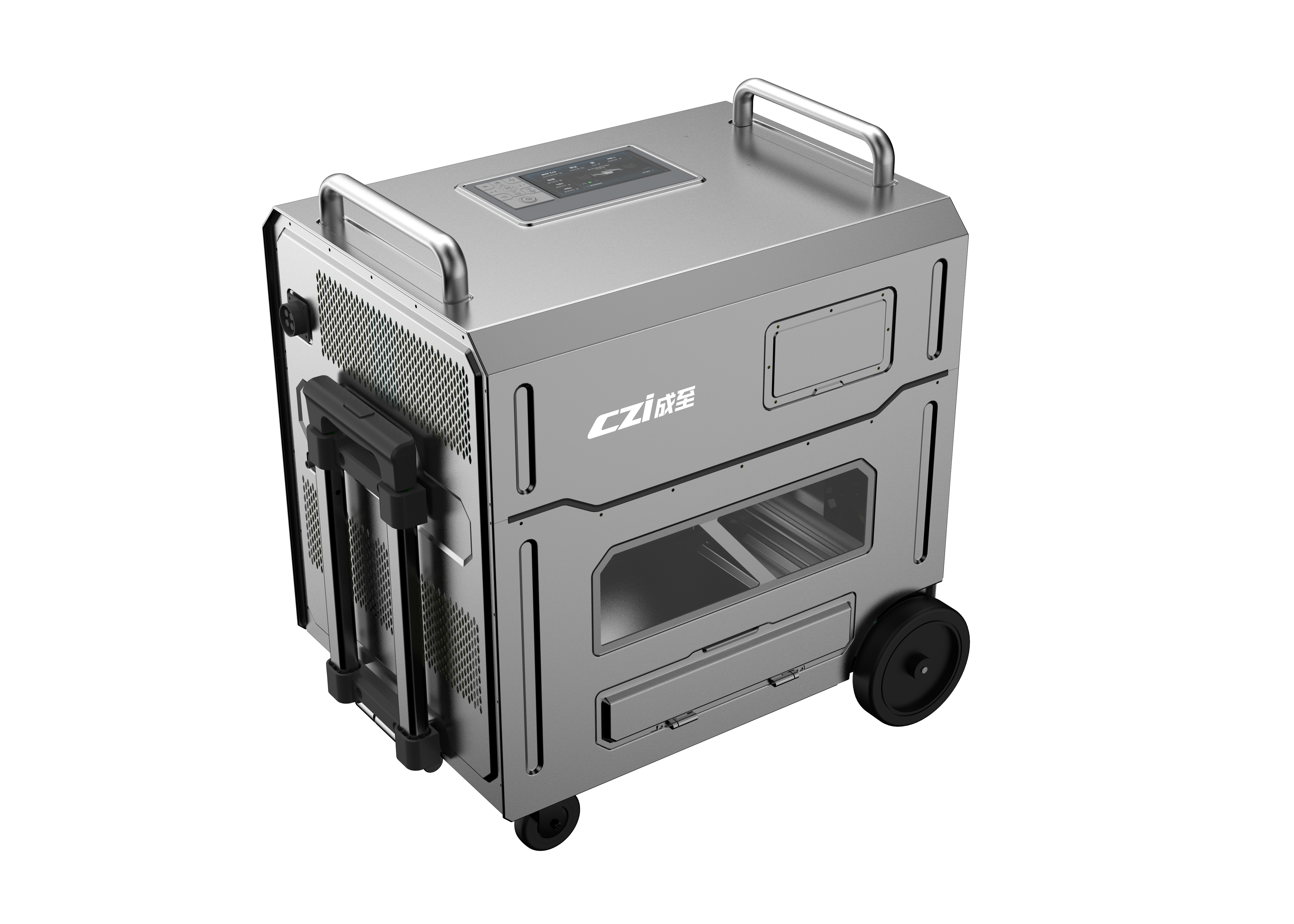
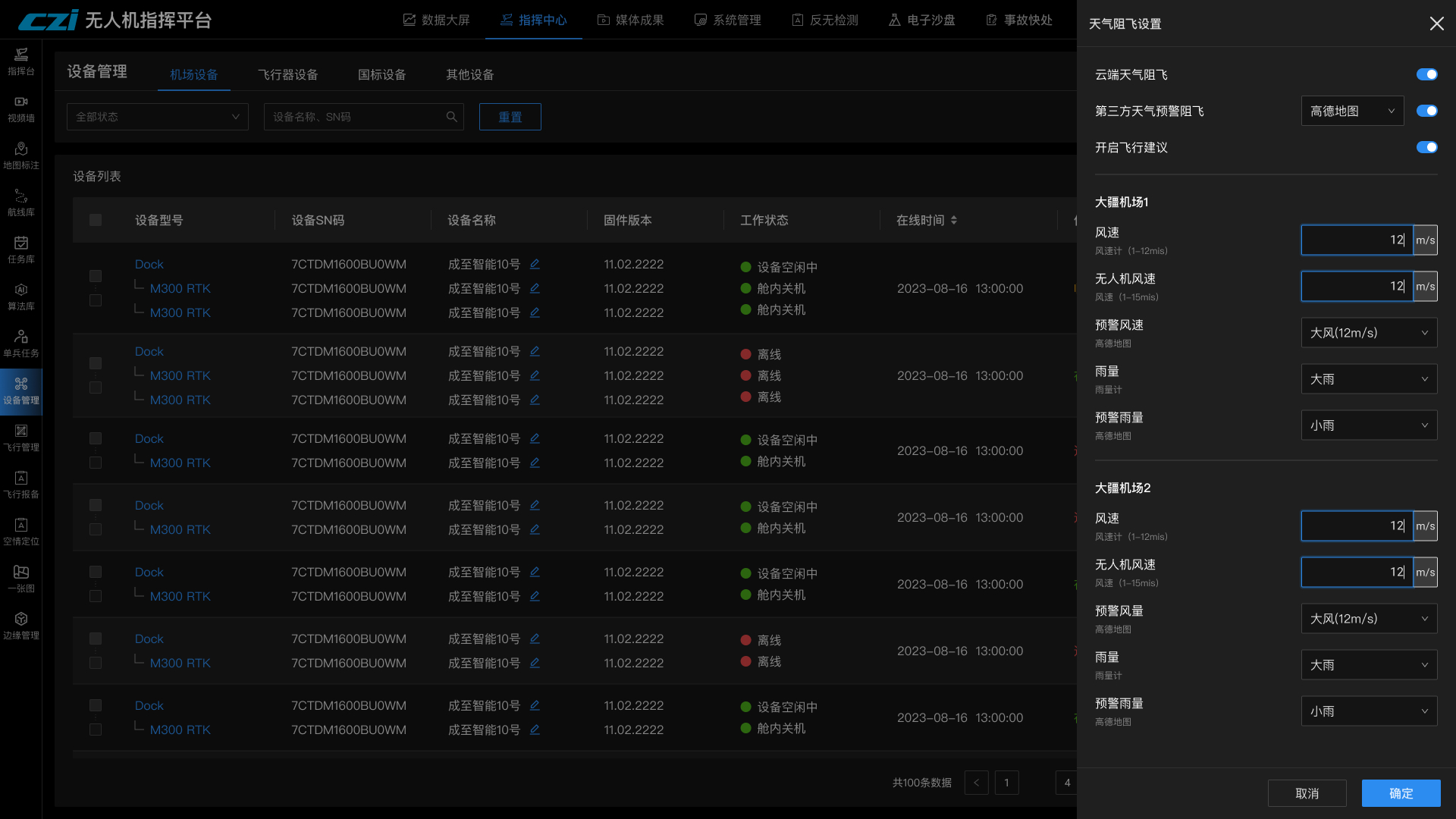
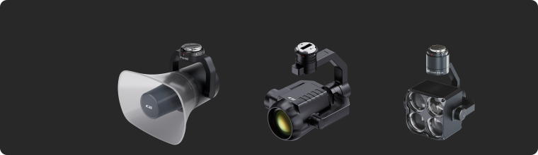
Supported Device
Breaking down ecological barriers, the platform enables unified access and management of cross-brand and cross-category devices.
It has been adapted to mainstream multi-type devices in the market, with more manufacturers being integrated progressively.
It has been adapted to mainstream multi-type devices in the market, with more manufacturers being integrated progressively.
 UAV Mission Payload
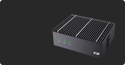 Edge Computing
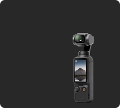 Consumer Imaging Devices
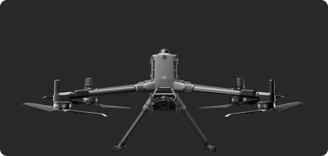 Industry-Grade UAV
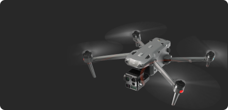 Consumer-Grade UAV
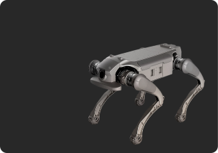 Quadruped Robot
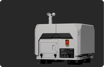 UAV Dock
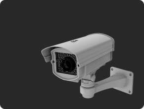 Surveillance Camera
 More Devices